| Developer required for pothole identification |
| Written by Harry Fairhead | |||
| Sunday, 15 May 2011 | |||
|
The city of Boston has already devised a novel Android app for pothole identification and has now posted a bounty of $25,000 for an algorithm to improve it. Street Bump is an Android app that uses the the phone's accelerometer to chart potholes in the road as a car drives over them, then broadcasts a GPS tagged report to city authorities.
It was developed by Boston's Urban Mechanics office in collaboration with Worcester Polytechnic Institute and the Santa Fe Complex, a technology think tank in New Mexico and was released in February. Its advantage is that it requires no direct user involvement. The app, for Android devices only at the moment, uses GPS data to track location and detects potholes by using the phone's built-in accelerometer to sense sudden jolts.
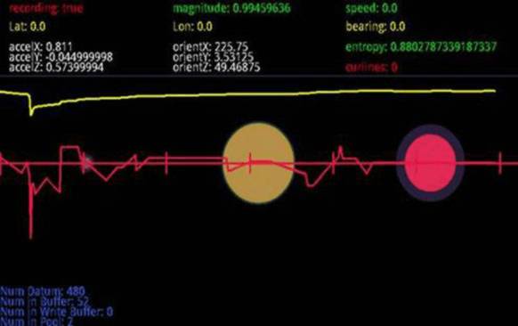
Feedback from StreetBump - circles are suspected potholes (New Urban Mechanics)
When multiple phones report the same jolt, the app identifies a pothole that needs to be repaired. Its disadvantage is that a high proportion of the "potholes" detected are false positives. What is needed is an algorithm that enables the phone to tell the difference between a pothole and a speed bump or elevated crosswalk, railway crossing or sewer grate.
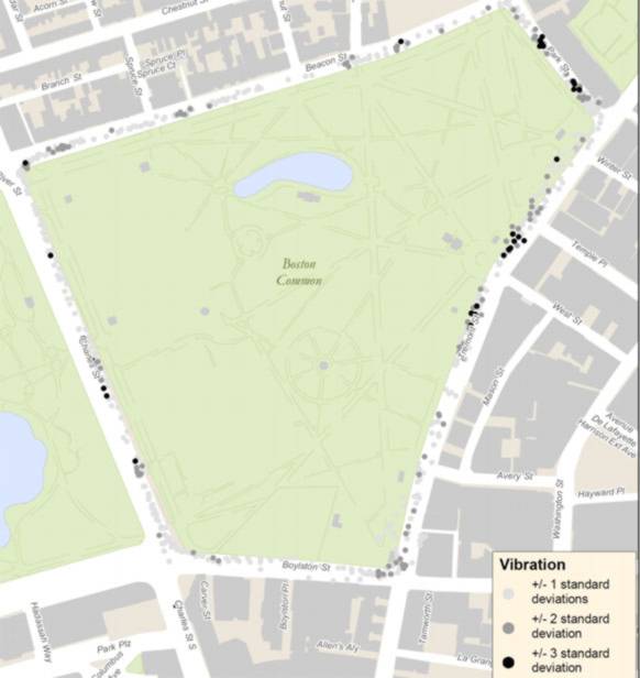
Results from an area of Boston that was tested for potholes, New Urban Mechanics
So now Boston has posted a challenge on Innocentive.com with an award of $22,500 for: a computer algorithm that can accurately identify the location and severity of potholes, given a large and dynamic set of acceleration and position data A further $2,500 is set aside for a solution from a Boston city resident or a full-time student at a Boston college or university. The deadline for the challenge is July 29, 2011 and full details can be found on the Innocentive site where it is free to register to become a Solver.
|
|||
| Last Updated ( Sunday, 15 May 2011 ) |


