| Google's post-earthquake mapping and imagery |
| Written by Ian Elliot | |||
| Sunday, 13 March 2011 | |||
|
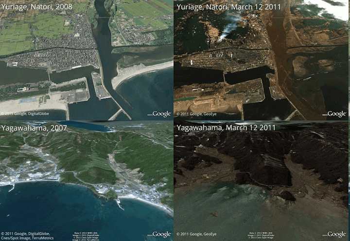
Google has been quick to respond to the Japan earthquake and tsunami to provide information, map and high resolution satellite imagery with before and after photographs of affected areas. Google began work on a Crisis Response Information Page for the March 11, 2011 Japan earthquake even while the initial tremor was in progress. A blog post by Ken Miura tells how he was working in Google's Japan office on the 26th floor of a building in Tokyo when the tremor started and rather than leave the swaying building he started to search for information about the event's epicentre and scale. As aftershocks continued to rock the building he and colleagues went to work to provide online information, such as where to find shelter and how transportation services were affected to victims of the crisis. In another initiative the Google Earth and Maps team has worked with its satellite imagery providers to create high resolution photographs and map overlays of images of the areas most affected by the earthquake and tsunami.
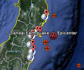
Some before and after photos have been posted to a Picassa album. As well as raising awareness of the level of devastation suffered in coastal areas these images will help in the disaster relief effort. The team has produced a KML files to add information to Google Earth so you can view selected areas both before Friday's devastation and afterwards. Simply download the file usin the link above and open it using Google Earth.
Double clicking on the blue and white icons in Google Earth auto-pans and zooms into the new sat imagery showing the current state of things. If you deselect the image in the Temporary Places directory then you can see the before view of the same area which is just hidden by the new image. It makes you wonder how far we are away from a realtime earth view? Related article:
|
|||
| Last Updated ( Sunday, 13 March 2011 ) |


