| Google Maps Weather Layer API |
| Written by Ian Elliot | |||
| Friday, 06 April 2012 | |||
|
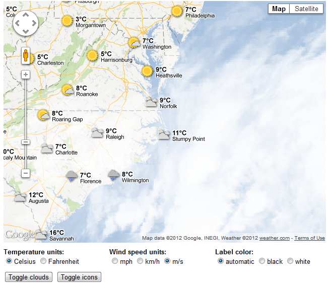
The weather layer launched on Google Maps about 9 months ago and it has been irritating not to be able to access it via the usual Mapping API. Now an intern working with the Google Maps team in Sydney has extended the API to let you control the weather - layer, that is. There is currently no full official weather API for Google maps, and it is unlikely there will be in the future because of the licencing deal between Google and the Weather Channel. There is an unofficial API that results from reverse engineering the Rest style calls actually made to display any data, but this isn't guaranteed not to change or to become unavailable via the use of encryption say. The new API gives you access to a lot of the facilities of the weather layer. You have to load an additional library to make use of it but this isn't difficult. There are two new classes WeatherLayer and CloudLayer.
The WeatherLayer class allows you to display weather data on the map and configure details such as temperature units, color etc. The user can also see a forecast for the next four days if they click on a location. You can also gain access to the same information via the mouse event object's featureDetails property. Of course, there are ways of getting this same data programmatically firing the event and changing how the data is presented. You can also disable this feature. The cloud layer can be enabled to produce cloud imagery at zoom levels 0 through 6. You may not be able to gain access to the Weather Channels data directly using this API, but the effect is very similar. It should allow you to create your own weather apps, or more likely weather information as part of a more complex geographical application.
More InformationRelated ArticlesGoogle Introduces Charges for Google Maps APIs An Interactive Google Earth KML Editor Getting started with Google Earth Getting started with Google Maps Location Aware Applications (Book Review) Beginning Google Maps API 3 2nd Edition (Apress) (Book Review)
Comments
or email your comment to: comments@i-programmer.info
To be informed about new articles on I Programmer, subscribe to the RSS feed, follow us on Google+, Twitter, Linkedin or Facebook or sign up for our weekly newsletter.
|
|||
| Last Updated ( Friday, 06 April 2012 ) |


