| Bing Maps Adds Spatial Maths Geometry |
| Thursday, 18 August 2016 | |||
|
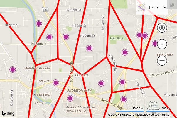
There's an update to Bing Maps 8 that adds support for spatial geometry calculations. The Bing Maps control can be used to add maps to your applications and display data with a spatial element. There are 24 new spatial geometry calculations in the Spatial Math module, including binary operations of shapes (intersection, difference, union), convex and concave hulls, Voronoi diagrams, and shape validation.
Another addition in the updated version is support for custom overlays so you can create your own custom rendering layers with the map control. Pushpins have been improved in two ways. Firstly, you can create a clickable pushpin area that more closely matches the area of the drawn image. In the previous release, the white space around the pushpin area blocked mouse events from getting to the pushpins below it. V8 now lets you specify that a rounded click area should be used instead. There's also an easier way to move pushpins by setting them to be draggable. Shape styling is another area to have received attention. In the previous release, you could only specify a single default style that would be used to style all the data from the GeoJSON module and the Query API. The only way to style individual shapes was to loop through the results and apply the logic to style each shape individually. In the updated version, you can set Bing Maps to use any Pushpin, Polyline or Polygon option for individual shapes through the shapes GeoJSON properties or as a data source column in the Bing Spatial Data Services. The final main improvement to the control is the release of the official TypeScript definitions for Bing Maps 8 on Github.The The definitions can be used to provide intellisense and better error catching to your IDE, so that, for example, the intellisense for events shows a list of the supported events so you can immediately verify the correct event name, view the structure of the event argument is known and access its properties. Releasing the definitions on Github is designed to overcome the problem that while Bing Maps V8 continues to get new features, the definitions only contain the features which are in the main release branch. By making the definitions open source on Github, anyone can download and modify them.
More InformationRelated ArticlesDeep Learning Powers BING Voice Input SDK for Bing Spatial Data Services Bing Maps for Metro Style Apps Getting started wth Bing Maps (Virtual Earth) Where are you from? IP Geolocation
To be informed about new articles on I Programmer, sign up for our weekly newsletter,subscribe to the RSS feed and follow us on, Twitter, Facebook, Google+ or Linkedin.
Comments
or email your comment to: comments@i-programmer.info |
|||
| Last Updated ( Thursday, 18 August 2016 ) |


