| DIY Streetview |
| Written by Harry Fairhead |
| Sunday, 10 June 2012 |
|
If you want to add your own Google-style Streetview to Google Earth, or via your own server, the good news is that now you can. The hardware and the software is available off the shelf. Google Street View is one of those ideas that once you have seen it you can't believe it took so long to invent. The fact of the matter is that it is fairly difficult and complex to get right, even when you know how it's done. If you are tired of waiting for the Google Street View car, trike or trekker, to visit your location, why not do-it-yourself?
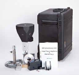
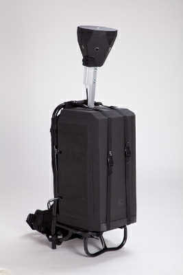
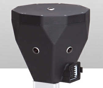
You can now buy a complete Streetview Kit from German designer Jan Martin. You can buy a 360 x165 degree camera that you can carry on a backpack or mount on the roof of a car. The camera is complete with GPS and takes a 7500x3750 picture every 3 seconds. The accuracy is about 15 feet but you can add your own GPS positioning device if you need more. The GPS provides the direction the camera is looking in and this makes it possible to automatically process the images. The data is stored on SD cards and the maximum recording time is 6 hours using a set of 32GB cards.
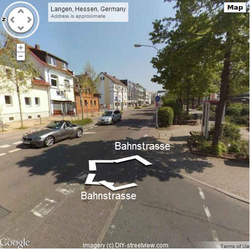
Once you have recorded the data you can process the captured images using a local image processing server. This is Ubuntu-based and can take the raw data and produce panoramas based on the geotagged images and tiles, suitable for use in Google Street View. The bad news is that it takes 24 hours to process 6 hours worth of data capture - but this means you can probably keep up with one camera per day per server. Once the data has been processed you can view it using a customized Street View app via the official Street View API. You can serve the views from your own hardware/website or you can prepare KML files for use with Google Earth.
You can also opt to incorporate your data into OpenStreetMap, which is rapidly becoming a challenger to Google's mapping. There are clearly lots of commercial applications of personalized Street View capture. Using the Street View API you can for example overlay extra data and generally customize things. It could also be used to create imaging in emergency situations - put one on top of a mobile robotic platform, and drop it from the air for a "as-if-you-where-there" experience.
More InformationDemos: http://www.diy-streetview.com/google-custom-streetview-player Stand-alone, displaying some extra data: Stand-alone, with OpenStreetMap map: Related ArticlesGoogle extends support for Bletchley Park
To be informed about new articles on I Programmer, install the I Programmer Toolbar, subscribe to the RSS feed, follow us on, Twitter, Facebook, Google+ or Linkedin, or sign up for our weekly newsletter.

Comments
or email your comment to: comments@i-programmer.info |
| Last Updated ( Sunday, 10 June 2012 ) |