| Balloon and Kite Imagery in Google Earth |
| Written by Harry Fairhead | |||
| Thursday, 19 April 2012 | |||
|
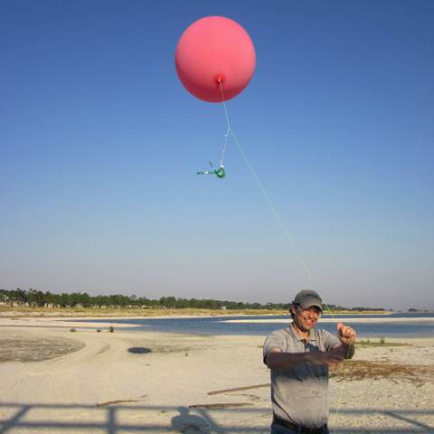
You can now see high resolution images taken using kites and balloons within Google Earth. What is more, you can take your own using a low cost kit and contribute to the project.
The Public Laboratory for Open Technology and Science (PLOTS) started out as a project to create DIY maps, including satellite imagery, using low cost kites and balloons.
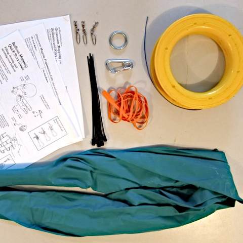
It has developed an open source kit that costs around $100 in total and works with a point and shoot digital camera. More importantly it also provides an open source web-based tool called MapKnitter which makes it possible to align the photos into a georeferenced tiled image that can be used in Google Earth or similar mapping tools. As a sort of demonstration, some of the images have been included into Google Earth's historical imagery layer. They can be a bit difficult to find so there is also a KML file that you can load into Earth to allow you to "fly" to the locations.
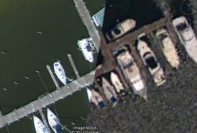
One thing that you will notice if you explore the examples, is that the quality varies greatly. However, when you find an example that has achieved a reasonable result, you can see the potential that the technique has. The image below shows balloon imagery on the left and satellite imagery on the right.
This all sounds like fun but is there a serious application? According to PLOTS there most certainly is: Maps are often used by those in power to exert influence over territory, or control territorial narratives. "Grassroots mapping" attempts to invert this dynamic by using maps as a mode of communication and as evidence for an alternative, community-owned definition of a territory. It cites various success stories including mapping oil spills and proving that communities left off official maps actually exist. An archive of photos is maintained so that the public can gain access to the efforts of the DIY map makers. More InformationThe Public Laboratory for Open Technology and Science
Comments
or email your comment to: comments@i-programmer.info
To be informed about new articles on I Programmer, subscribe to the RSS feed, follow us on Google+, Twitter, Linkedin or Facebook or sign up for our weekly newsletter.

|
|||
| Last Updated ( Saturday, 21 April 2012 ) |